This tool visualizes weather data from the German Weather Service (DWD) for VFR pilots.
The core value proposition is resolution (2.1km grid, ~150,000 cells covering Germany)
and recency (updates within minutes of new model runs).
The viewers
Ceiling – Cloud base height, colored like GAFOR categories
Radar – Simulated radar from model data with significant weather symbols (nowcasting)
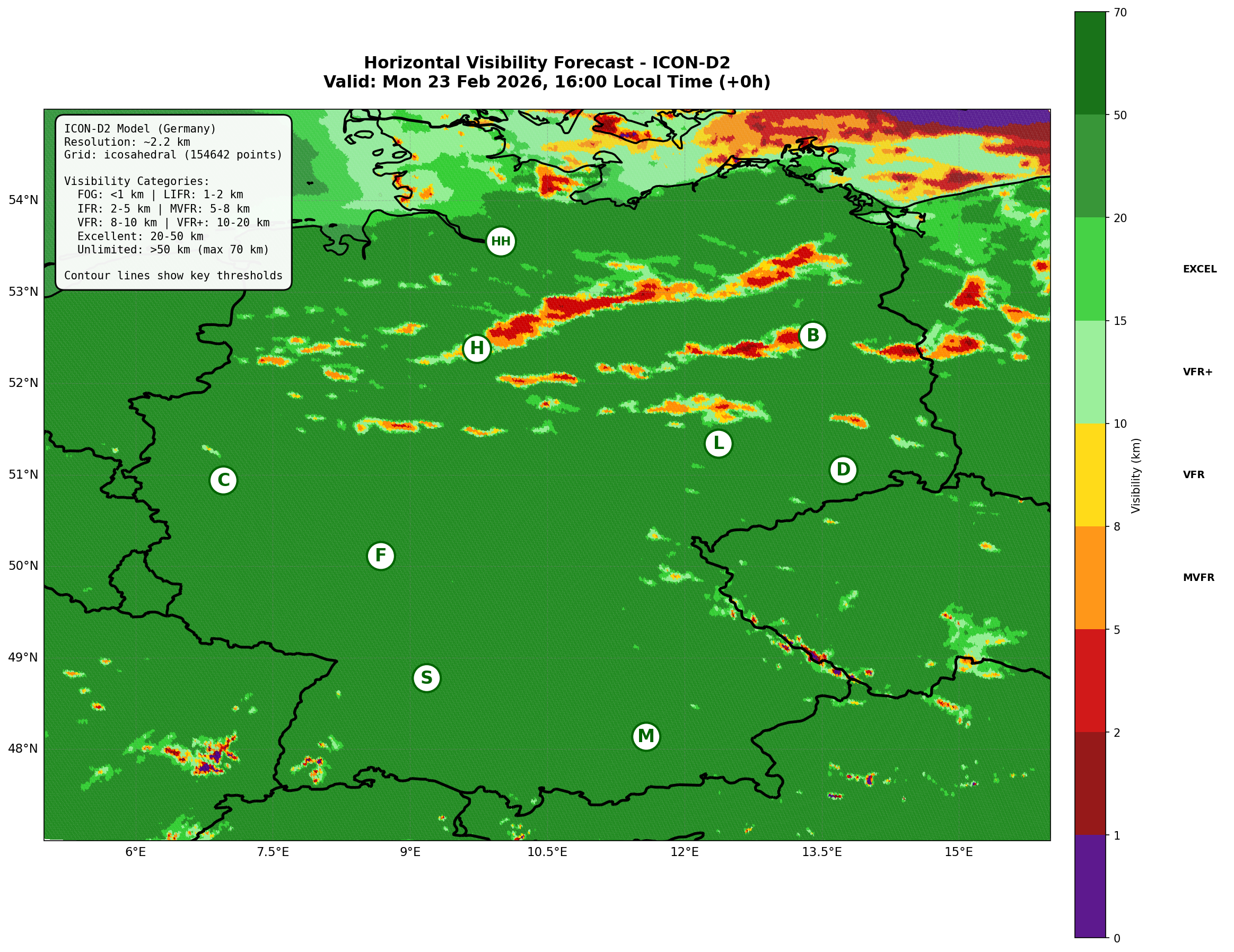
Visibility – Horizontal visibility in meters
Precipitation – Rain/snow/graupel intensity
Convection – CAPE index for thunderstorm potential
Meteograms – Time series for any German airfield with 20 cloud layers
Route – Cross-section along your flight route with wind optimization
Two data sources, one timeline
This app combines two DWD models to give you the best of both worlds:
Hours 0–14: ICON-D2 RUC (Rapid Update Cycle) Updated every hour with 15-minute time steps – ideal for nowcasting
Hours 15–48: Conventional ICON-D2 Full model run every 3 hours, extends the forecast to 48 hours
The RUC excels at short-term accuracy: it assimilates the latest observations hourly,
making it excellent for "what's happening right now" decisions. The Radar viewer uses
RUC data exclusively for the first 14 hours, showing simulated reflectivity and
significant weather symbols (rain, snow, freezing rain, thunderstorms).
Meteograms
Meteograms use conventional D2 data only, because RUC lacks the detailed vertical cloud
structure (RUC has only "low/mid/high", while D2 provides 20 altitude levels up to 10,000ft).
Bandwidth note
The map viewers load high-resolution pre-rendered images. A fast internet connection
(ideally WiFi or wired) is recommended. Using mobile data may consume significant
bandwidth and could be expensive.
Disclaimer
This tool is provided for informational purposes only and is not a substitute for
official weather briefings. Always use authorized sources (DWD, Flugwetter.de, AIS)
for flight planning. The author assumes no liability for decisions made based on this data.
Model forecasts can be wrong – always have a Plan B.